North Carolina Board Threatens Private Drone Mapmakers Because They Aren't Licensed 'Surveyors'
Technological innovation makes gathering visual land data easier and cheaper—and threatens an industry’s status quo.

Do you actually need to be a state-licensed surveyor in order to use drone technology to map out private property? A collision between drone-driven entrepreneurial innovation and occupational license gatekeeping in North Carolina has led to a lawsuit.
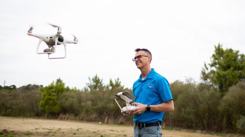
Michael Jones launched a drone photography business in Goldsboro, North Carolina, in 2016, taking aerial photos of private property (on behalf of the property owners) and using tech tools to put the images together as maps. According to the Institute for Justice, which is representing him, Jones' business—360 Virtual Drone Services—did not represent or market itself as engaging in "land surveying." The maps he created were not designed to be used to establish legal property boundaries.
These were maps developed for property owners' and developers' purposes, like determining ways to alter the land and to evaluate the state of their property. Jones is simply using drone technology to collate images of property and present them in topographical maps and 3D visualizations.
This has run Jones afoul of North Carolina's Board of Examiners for Engineers and Surveyors, which oversees the licensing of professionals in these fields. In 2018, the board sent Jones a letter telling him he was being investigated for possibly engaging in surveying without a license. Then, in 2019, he was sent a cease-and-desist letter telling him to stop his mapping work. If he did not, he faced the possibility of civil and even criminal charges for engaging in surveying work without a license. He could be fined up to $1,000 and get sent to jail for up to 60 days.
The board is claiming that essentially any form of map making that Jones is doing with his drone counts as "surveying," even if he's not creating them to be used for legal purposes. And so, in order to "legally" take pictures and combine them into maps with his drone, Jones needs to acquire the appropriate degrees, pass examinations, and get licensed.
Under such a threat, Jones stopped using his drone to make maps and got legal representation. On March 22, the Institute for Justice filed a lawsuit in the U.S. District Court for the Eastern District of North Carolina, arguing that the Board's licensing program violates Jones' First Amendment rights.
"The problem is when you define surveying as simply collecting and disseminating data about land, you're getting into First Amendment territory," Institute for Justice Attorney Sam Gedge tells Reason. "Basically, you don't need the government's permission to create information and sell that information to willing people. Communicating information is speech, and it's protected by the First Amendment."
At the heart of the conflict is the surveying industry disruption being caused by the development of cheaper drone technology. Gedge noted that, historically, when the owner of a large tract of property (like a mall or farm) needed visuals and maps, this required expensive technology and likely the rental of a plane for a flyover. Jones was offering a cheaper alternative, sending a drone hovering overhead, taking dozens of photos that could be automatically stitched together (without requiring years of professional training).
"Now that commercial drones are relatively affordable, you're seeing people able to offer services that were the sole preserve of licensed professionals," Gedge says. And some of those professionals aren't going to take that lying down. The Institute for Justice lawsuit notes that Jones is not the only drone operator to have received threats from the Board. At least six other drone companies have received similar cease-and-desist letters accusing them of engaging in surveying without a license.
Jones' lawsuit is asking the court to determine that these licensing demands violate the First Amendment. The suit also seeks an injunction stopping the Board from enforcing any bans on "taking aerial photographs and for collecting, processing, disseminating, and selling images of and information about land and property (including distances, coordinates, elevations, and volumes)."
The Institute for Justice also produced a useful explainer video:
Editor's Note: As of February 29, 2024, commenting privileges on reason.com posts are limited to Reason Plus subscribers. Past commenters are grandfathered in for a temporary period. Subscribe here to preserve your ability to comment. Your Reason Plus subscription also gives you an ad-free version of reason.com, along with full access to the digital edition and archives of Reason magazine. We request that comments be civil and on-topic. We do not moderate or assume any responsibility for comments, which are owned by the readers who post them. Comments do not represent the views of reason.com or Reason Foundation. We reserve the right to delete any comment and ban commenters for any reason at any time. Comments may only be edited within 5 minutes of posting. Report abuses.
Please
to post comments
Yea, IJ! Take 'em down!
My last pay check was $8750 just ecom working 12 hours for every week. My neighbor have found the estimation of $15k for a long time and she hjk works around 20 hours for seven days. I can not trust how direct it was once I tried it information.. . Visit Here
I made them my Amazon Smile designated charity. So if anyone is feeling a little guilty making Bezos richer, that is one sliver of good that can come out of it.
Yeah these state licensing boards are quite the racket, but democrats love 'em because they can hassle and control the professional class of the meritocracy.
I am making over $9k a month working part time. I stored being attentive to different human beings inform me how much money they are able to make on line so I decided to lok into it. well, it turned into all actual and has completely modified my life.
That is what I do.... Money Star
You think it's just Democrats doing this? What color is the sky on your planet?
It's rent seekers all the way down.
So they'll be going after Google Maps next?
..."Hey, what's that blacked out section above South Carolina?"
After a month-long investigation revealed that Leonard Mushnik had developed fantasy maps for a D&D campaign, the licensing board determined that he was in fact engaging in surveying without a license.
we mapped ZORK as we played it
As long as you didn't take any aerial photos of Flood Control Dam #5.
lol you are standing in an open field west of a white house
Surrounded by fences and National Guard troops...
zork2021 ends @Leavenworth.
Or with a Grue named Nancy.
It may just be me, but doesn't North Carolina seem to pop up in a bunch of these licensing board lawsuits? Whether it's hairbraiding or dispensing diet advice or offering teeth whitening services, there seems to be a licensing board for everything in North Carolina.
If someone in NC is reading this, you'd better have your state commenter's license in order!
Are they marketing themselves as providing the same service as surveyors? Or just making maps for people who want a map of their land? Sounds like it's the latter.
Sounds to me like it's the latter, too. Or maybe something in between the latter and a high-res, custom version of the satellite imagery you can download from Google Earth Pro.
If they aren't representing themselves as licensed land surveyors or civil engineers, but rather providing a similar-ish service for completely different purposes, I don't see how the licensing board should be able to sanction them.
I don’t see how the licensing board should be able to sanction them.
You must live in one of those free states where the beer flows like wine, where the women instinctively flock like the salmon of Capistrano.
"At the heart of the conflict is the surveying industry disruption being caused by the development of cheaper drone technology. Gedge noted that, historically, when the owner of a large tract of property (like a mall or farm) needed visuals and maps, this required expensive technology and likely the rental of a plane for a flyover. "
My company, which offers professional surveying services, decided to get ahead of this trend, and offer the drone-based services as well. Now, at the time, you had to get an FAA drone license in order to profit off of anything produced by the drone flying, and that was a largely useless hurdle, but after that, we've got the same ability to get this sort of relatively cheap aerial photography as this gentleman.
Now, we have licensed surveyors who are also FAA licensed drone pilots doing the flying, so it's probably a bit more expensive on an hourly basis than this guy, but we offer the added benefit in that we CAN use it to create legal maps for use in real estate or construction documents, so there's some added benefit with the added cost.
P.S. As someone who is part of the 'industry being disrupted' - I have no problem with what this guy is doing.
Don't call them maps. Call them low resolution, high contrast, land portraits. Then they are clearly first amendment protected artistic images, not "surveys".
But you better hurry, because the first amendment is going the way of the second. Pretty soon the 9th district will declare the first as unconstitutional as the second.
Surveyors typically don't wall what they produce 'maps' either. They call them surveys, or plats, or topos, or ALTAs, etc.
This guy should be able to call them 'maps' just fine without running afoul of surveyors or civil engineers. Now, cartographers, on the other hand . . .
As a licensed UAV pilot I have seen this type of friction getting worse. Probably four of five years ago I went to a seminar about legal UAV issues. While most of the folks there were UAV pilots there was a helicopter pilot who was quite nasty and actually threatened several UAV pilots. It was clear he felt he was losing business to UAV pilots who were taking away business from him. They were only doing photography. None of the images they captured or sold were anything but simple images.
I also am a serious photographer and have seen similar issues with wedding photographers getting mad at amateur photographers once digital cameras got so good it did not really take a pro to produce great images.
Lots of jobs are going the way of buggy whip makers.
I'm also a licensed UAV pilot and work for a civil engineering firm. I don't see this guy losing this case. Several states have publicly available LiDAR and GIS info that you could use to 'Map' someone's property without having a surveying license.
You need the license to stamp legal docs, not to take pictures.
In modernity with GPS mapping technology you do not need to be a licensed surveyor to make a map of where things are. Licensed surveyors for the most part use the same technology to determine where new things are to be built or where changes to existing things go. There was a time when a surveyor was needed to go find exact locations but no longer is that needed for map making. Surveyors are also needed to mark exact locations for legal purposes, which takes much more sophisticated technology.
That helo pilot's day is about to get worse if some friends of mine work out what they have in mind for their drones. They are working on crop dusting. They can hit smaller fields, be more accurate and reduce the amount of spray that they use.
That's pretty cool, very smart, and eco-friendly.
Less waste, less spray, more efficient = more profit for both your friends and their clients. Hopefully.
Thank you for sharing a good article. It is really very helpful for us.
Look, spambot, unless this part time job involves flying drones and making maps I’m not interested.